Secure, Accelerated Mining & Geological File Transfer



Zero Per-User Fees
Deploy the MASV Desktop App and headless agent across hundreds of remote field laptops, drone docks, and survey teams without per-user license penalties.

A More Resilient Connection
Combine multiple sources (like satellite, 5G, and Ethernet) into an accelerated, more resilient pipe to guarantee fast transfers from remote exploration sites.

Secure Workflows
Preserve network isolation with outbound-only HTTPS (port 443) file transport, keeping sensitive data locked down without opening infrastructure to inbound threats.
How MASV Helps Mining Teams

The Challenge
Every hour of delayed data is an hour of delayed decisions – and in mining, that cost compounds fast.
Remote mines generate enormous volumes of operational data, from drill hole logs and high-res GIS surveys to autonomous fleet telemetry. But getting accurate geological data into centralized storage for real-time data analysis is a persistent bottleneck in modern mining operations:
- Exploration and spatial datasets routinely reach hundreds of GBs, often overwhelming limited network connections.
- Mine sites depend on unstable satellite or cellular links plagued by high latency, throttling, and frequent drops.
- Every hour of delay is an hour lost for drilling schedule decisions, safety assessments, maintenance planning, and data accuracy QA.
- Physical data movement by shipping transfer devices introduces security vulnerabilities, chain-of-custody gaps, and operational lag.

The MASV solution
MASV: The reliable bridge connecting remote mine sites to cloud and on-prem systems.
When operations run 24/7 and decisions depend on real-time data points, slow or failed file transfers are an operational liability. MASV's high-speed, reliable large file transfer gives field teams a browser-based, drag-and-drop upload portal that connects directly to existing cloud or on-prem systems:
- Move massive geological surveys, stratigraphic data, and drill logs at maximum speed without bandwidth bottlenecks or file package size limits.
- Never lose progress on a critical transfer: Automatic infinite retries resume from the exact point of failure if connections drop.
- Eliminate manual handoffs: Field data flows straight from remote geological projects into your storage infrastructure the moment it's captured, reducing human error.
- Keep exploration intelligence locked down with built-in enterprise-grade security including ISO 27001, SOC 2 Type II, and in-flight and at-rest encryption.
Built for Mining: Use Cases

Geologists and Geoscientists
Transfer seismic interpretation files and high resolution images from remote drill sites to shared storage without package size limits or corruption.

Mine Surveyors
Deliver high-res drone orthomosaics and volumetric surveys from active workings to engineering teams without babysitting unreliable uploads.

Exploration Teams
Push geophysical data sets, borehole logs, and hyperspectral imagery from remote camps using infinite auto-retry, so no transfer has to be restarted manually.

Mining Engineers
Share large-scale mine design files, ventilation models, and blast simulation data between pit, plant, and the office automatically.

Contractors and Drillers
Send a browser-based Portal link to on-site crews so they can upload operational data into a browser-based, drag-and-drop upload hub.

Asset Managers and Mine Owners
Maintain a secure, auditable pipeline for as-built documentation to meet regulatory and contractual obligations.
Seamless Upload and Ingest for Mining
The Six-Stage Sensor-to-Cloud Pipeline
Don't let massive field datasets and unreliable connections derail your operations. Use MASV to handle the heavy lifting for drill logs, GIS surveys, drone imagery, and everything else your sites generate:
- Configure: MASV Portals can be set up to send content to practically any destination, with all content automatically landing where it’s intended. MASV offers 30+ native cloud and on-prem integrations, or set up custom cloud or on-prem integrations via the API.
- Collect: Field sensors, LiDAR scanners, drones, autonomous vehicles, and other sources capture high-density survey and other mining data at the site.
- Upload: Watch Folders automatically upload captured datasets to your MASV Portal(s); a global network of 750+ edge nodes and Multiconnect channel bonding accelerates transport over one or multiple networks, even in unreliable network conditions.
- Ingest: MASV automatically ingests data into preconfigured cloud or on-prem destinations, calculating block-level SHA-256 checksums to maintain data integrity and auto-retrying from the point of failure in case of interruption.
- Deliver: Encrypted payloads land directly in your cloud or on-premises storage or system of choice.
- Process and act: Data feeds directly into Snowflake, Databricks, AWS SageMaker, or mining analytics platforms.
Why Top Mining and Geological Firms Choose MASV

Multi-Threaded Acceleration Optimized for 10Gbps+
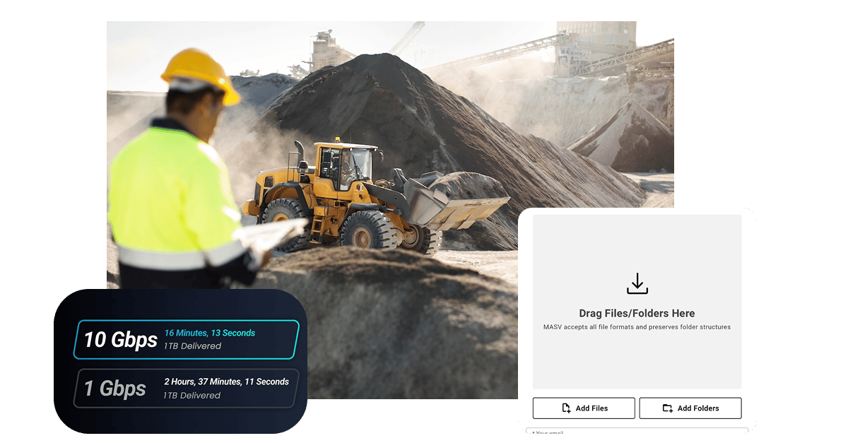
- Drive time to value and move terabyte-scale seismic datasets and LiDAR point clouds in minutes.
- MASV saturates your available bandwidth, bypassing the congested public internet.
- Massive geophysical and geographic information systems (GIS) files are split into encrypted segments and sent simultaneously over multiple streams, maximizing throughput.

Multiconnect for Speed and Resiliency
- MASV Multiconnect bonds multiple connectivity sources (like satellite, 5G, LTE, and site Wi-Fi) simultaneously into a single, faster, more resilient pipeline.
- If one connection drops, the others keep your transfer moving without failed uploads, restarting from scratch, or lost progress on a multi-gigabyte (or terabyte) transfer.

Relentless Reliability
- MASV automatically resumes interrupted transfers from the exact point of failure – infinitely – until the package is delivered.
- Field teams can walk away confident their data will arrive, even in the most isolated environments, without wasting time transfer hand-holding.

Automated Data Ingest
- Use Watch Folders to automatically upload data to one or multiple destinations the moment it's captured by autonomous equipment, survey instruments, and other field tools.
- Route drill logs, drone imagery, and geophysical exports directly to specific folders in your cloud or on-prem storage environment using metadata, without any manual handoffs.

Seamless Upload Portals
- Give contractors, drilling companies, and third-party consultants a browser-based, drag-and-drop upload link.
- Field crews drag and drop datasets directly in their browser and get back to work, with no MASV account, training, or software installation required.
- Handles all GIS, mining, geology, and earth science file formats; file restrictions allow admins to limit uploads to certain file types.

Connect Your Infrastructure
- MASV connects directly to the cloud and on-prem storage platforms your operation already runs on, from Amazon S3, Azure, OneDrive, and SharePoint to Synology, QNAP, and more.
- Immediately deploy native integrations or set up custom integrations using the MASV API and Agent.
- Receive Slack notifications the moment field data lands in storage and is ready for processing and analysis.
Why MASV Over Other File Transfer Tools?